blah blah blah
East Royce Mountain
Length: 3.2 miles out-and-backDifficulty (click for info): Hard
Elevation Gain: 1650 feet
Rating (click for info): 7/10
Elevation: 3114'
Prominence: 504'
Driving Directions:
Trailhead and parking area are on Maine Route 113 in Batchelder's Grant, ME. Note: because of the confusion which can arise from two different Rt. 113's (NH 113 and ME 113) being so close to each other, we have given directions for this particular hike from Conway. From the junction of NH 16 and NH 113 in Conway, drive east on NH 113. In 2.0 miles, Rt. 302 joins from the left; continue straight on Rt. 302/113. In 4.7 miles, NH 113 ends, and the road, now only Rt. 302, crosses the Maine border. In 1.1 miles from the border (5.8 miles from jct. 302/113), turn left onto ME 113 (River Street). Drive 1.2 miles (crossing back into NH), then turn right to stay on ME 113, now East Conway Road. In another mile, turn right again to stay on ME 113, now called West Fryeburg Road, crossing back into Maine. In 4.4 miles, turn right one more time to stay on ME 113 where NH 113B continues ahead. In another 3.1 miles, NH 113B enters from the left, the name of the road changes to Main Road, and it crosses the state line back into NH. Continue 7.9 miles, passing several other trailheads and crossing the state line back into Maine. The road narrows and climbs steeply to its highest point on the east wall of the notch, where there is a scenic overlook. The parking area is located on the left after this, when the road descends to the actual notch.
About the Hike:
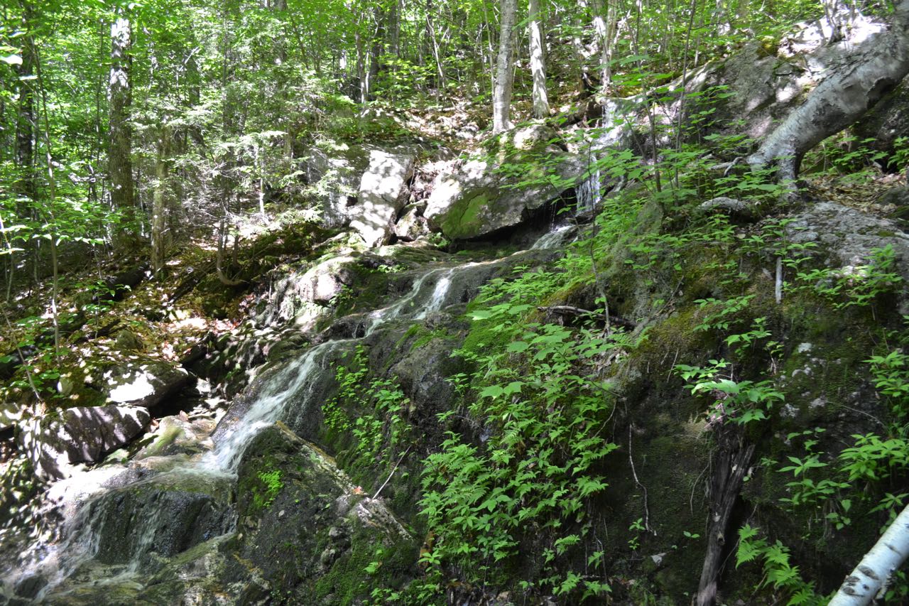
Technically being in Maine should not discourage New Hampshire hikers from checking out the fabulous ledges on this rugged peak in the Evans Notch region. Its relative, West Royce, was chosen for the 52 with-a-view list despite being greatly inferior in scenic beauty to East Royce. For those not interested in checking off 52WAV's, Maine's East Royce will please. It offers a majestic view to the south of the other peaks of the Baldface Range, of which it can be considered the northernmost major peak. Hiking to East Royce is not one of the region's longest or hardest treks, but it will certainly give you a breathless, tiring climb. For 52WAV explorers and those hopelessly obsessed with seeing every possible view, click here for the hike to both Royces. The trail begins at the highpoint of Evans Notch, the least developed major-road-acessible mountain pass in the White Mountains. The trail sets off into the forest, crossing a minor stream named Evans Brook and immediately ramps up the steep wall leading out of the notch. As the trail swings to the left to angle across the slope, it crosses a different tiny brook at a ledgy area above a fine cascade (this minuscule waterway will eventually become the Cold River). There is not a good view of the waterfall from here, but it is worth the slight effort to walk down off the trail to the base of the tumbling cascade.
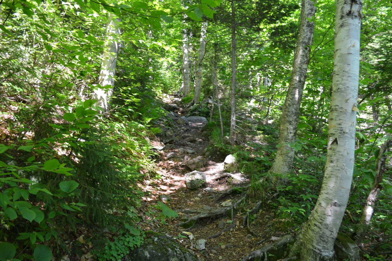
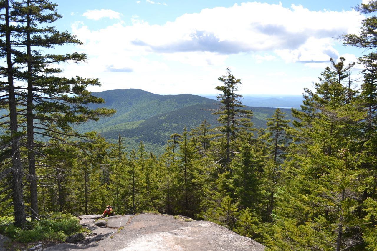
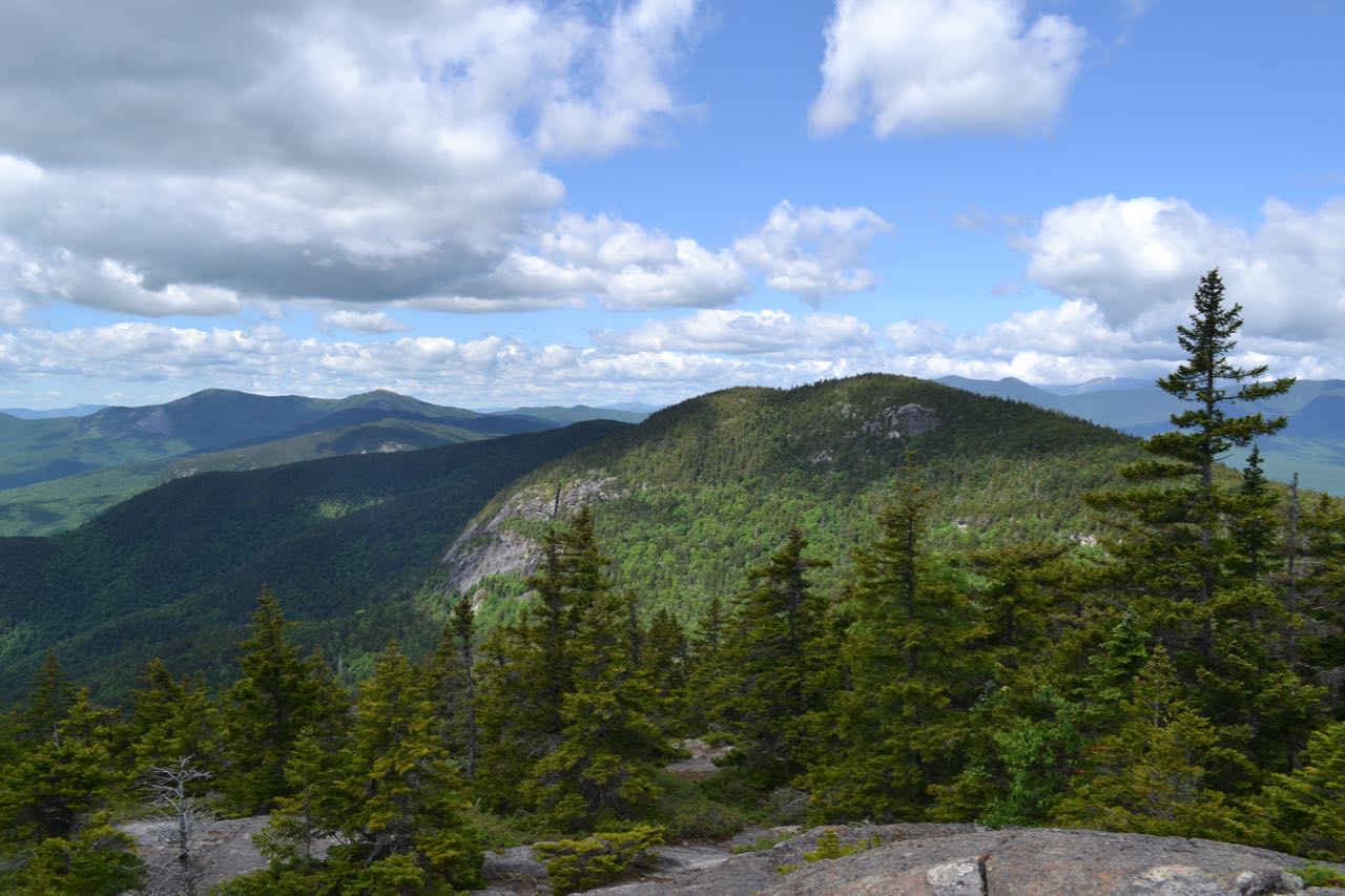
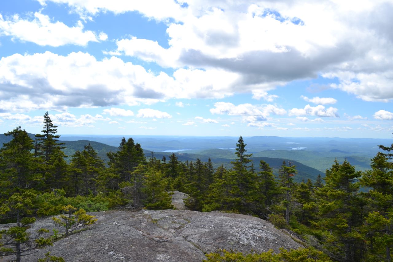
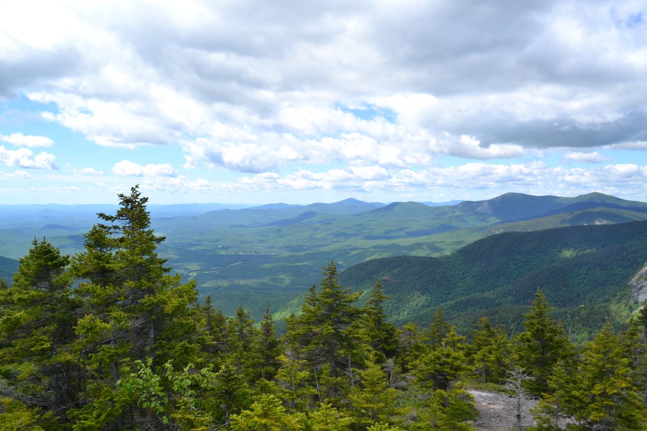
From here, the trail begins its ascent of a northeast ridge which protrudes from the mountain's southern shoulder. The trail's upper section comes fairly close (not within sight) of the incredibly steep slope plummeting down into the drainage south of the Evans Notch highpoint, which you drove across from if you came from the south. In the bottom section of the climb, the trail crosses many small and seasonal streams; closer to the top, it becomes steeper and switchbacks through darker, coniferous woods. After a mile of relentless climbing, the trail begins to level out and reaches a junction with Royce Connector. This trail is used to access the Royce Trail to West Royce. To continue to East Royce, turn right to stay on East Royce Trail and quickly resume the rugged ascent over roots and rocks. This is the steepest part of the ascent. After 0.3 miles and several tricky rock scrambles, the trail climbs up a sloping ledge with the first view. This ledge views east to Speckled Mountain in the Caribou-Speckled Mountain Wilderness. Continue climbing alongside and over more ledges for 0.2 miles to a large open area marked by a trail sign. Here, just across the plateau from the true summit, you will find a wild, rugged vista. The flat expanse, spotted with lakes, sprawls endlessly to the east beyond Speckled Mountain. To the south, you gaze down the impressive Baldface Range, starting with West Royce and its striking cliff face. The Baldface Range rolls down to the west into the extensive Wild River valley, mostly hidden by the peaks. The massive Carter Range rises across in the distance.
Printable directions page